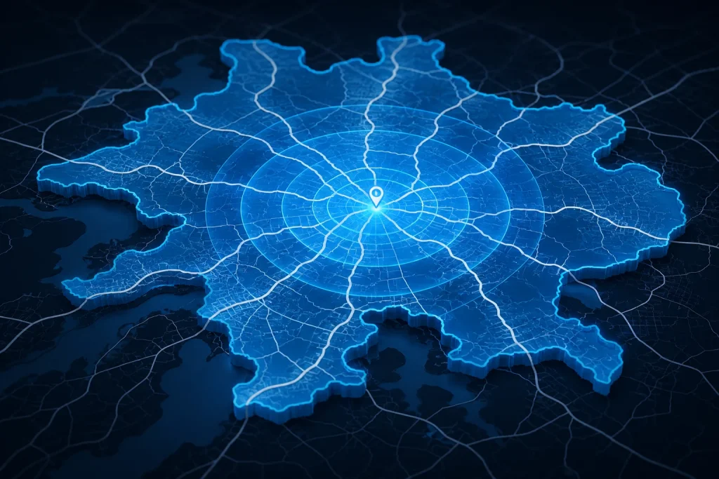
A driving radius map shows the area you can reach by car from a starting location within a chosen driving time or road-distance limit.
Unlike a simple geographic radius, a driving radius follows the road network. Highways may stretch the reachable area farther in one direction, while rivers, mountains, sparse roads, one-way systems, and restricted connections can shorten it elsewhere.
If you want a fixed straight-line circle such as a 10-mile radius, use the Map Radius Calculator instead.
What Is a Driving Radius?
A driving radius represents road-based reachability from one starting point.
For example:
30-minute driving radius
means:
the area that can be reached from the origin in approximately 30 minutes by car under the routing assumptions being used.
A driving radius can also be based on road distance:
25-mile driving radius
means:
the locations reachable through the road network within approximately 25 route miles from the origin.
These boundaries are usually irregular rather than circular.
What Is a Drive Time Map?
A drive time map is a map that shows how far you can travel by car within a specified amount of time.
Examples include:
- 10-minute drive time;
- 15-minute drive time;
- 30-minute drive time;
- 45-minute drive time;
- 60-minute drive time.
A routing system expands outward through the road network until the selected travel-time threshold is reached.
The resulting boundary surrounds the locations that meet that travel-time condition.
This type of boundary is commonly called an isochrone.
What Is an Isochrone?
An isochrone is a line or polygon representing locations reachable from an origin within the same travel-time limit.
For example:
30-minute driving isochrone
shows the area that can be reached in about 30 minutes by car.
The word comes from concepts meaning:
equal time
In mapping applications, isochrones can be created for:
- driving;
- walking;
- cycling;
- public transportation;
- other travel modes.
A driving radius is therefore often more accurately described as a driving isochrone when the boundary is based on travel time.
Driving Radius vs Straight-Line Radius
These two map types solve different problems.
Straight-Line Radius
Measures equal geographic distance from one center.
Example:
10-mile radius
Every point on the ideal boundary is approximately 10 straight-line miles from the center.
Driving Radius
Measures reachability through roads.
Example:
30-minute driving radius
Every area on the boundary is associated with approximately the selected driving-time threshold.
The driving boundary may stretch along highways and contract around geographic or road-network barriers.
Why Isn't a Driving Radius a Perfect Circle?
A road network is not equally fast or equally connected in every direction.
Imagine a location with:
- an interstate highway to the east;
- local streets to the west;
- a river to the south;
- mountains to the north.
Within 30 minutes, a driver might reach:
30 miles east
but only:
12 miles north
and:
8 miles south
The boundary therefore becomes irregular.
A perfect circle would incorrectly assume that travel is equally easy in every direction.
How Is a Driving Radius Calculated?
A driving radius is calculated by expanding outward through a road network from one origin while tracking accumulated travel cost.
The general process is:
Starting Location
↓
Geographic Coordinates
↓
Road Network
↓
Routing Model
↓
Time or Distance Threshold
↓
Reachable Road Positions
↓
Boundary Polygon
The final polygon represents the road-network region reachable within the selected limit.
What Data Does a Driving Radius Need?
A real driving-radius calculation requires more than one coordinate.
It typically needs:
- origin coordinates;
- road geometry;
- road connectivity;
- travel direction;
- road-access restrictions;
- route speeds or travel-time weights;
- distance or time threshold.
A simple geographic radius needs only:
center + radius
That is why a true driving-radius calculation is computationally more complex.
How Is a Drive-Time Radius Different From a Driving-Distance Radius?
Both use the road network, but the limiting condition differs.
Drive-Time Radius
Uses:
travel time
Example:
30 minutes
The routing engine expands through roads until the estimated accumulated time reaches the threshold.
Driving-Distance Radius
Uses:
road distance
Example:
25 driving miles
The routing engine expands until accumulated route distance reaches 25 miles.
These can produce different shapes.
A fast highway can allow a driver to cover many miles within 30 minutes, while dense city streets may allow far fewer.
What Is a Travel Time Radius?
A travel time radius is another name for a reachable-area map based on time.
For example:
20-minute travel time radius
can mean all locations reachable in approximately 20 minutes.
The transport mode matters.
A 20-minute radius by:
- car;
- bicycle;
- walking;
will produce completely different boundaries.
For driving specifically, the result is a drive-time isochrone.
How Does a Driving Radius Use Roads?
The routing system follows connected road segments outward from the center.
Each road segment can contribute:
- distance;
- estimated duration;
- routing cost.
The system can also account for network properties such as:
- one-way streets;
- turn restrictions;
- road classes;
- speed assumptions;
- access restrictions.
The boundary emerges from the reachable parts of that network.
It is not created by drawing a circle and then adjusting it visually.
Why Do Highways Stretch a Driving Radius?
Highways allow a vehicle to cover more distance in a given amount of time.
Suppose you have two directions from the same origin.
Direction A
Highway travel:
60 mph
Direction B
Urban streets:
25 mph
Ignoring stops and other effects, 30 minutes at 60 mph could cover about:
30 miles
while 30 minutes at 25 mph corresponds to:
12.5 miles
This is why drive-time maps often develop long extensions along highways.
Why Do Cities Shrink Drive-Time Areas?
Urban travel can involve:
- lower speed limits;
- traffic lights;
- intersections;
- one-way streets;
- congestion;
- complex turns.
Even when the road network is dense, the distance covered in a fixed time can be relatively small.
A 20-minute drive in a city center may cover far less geographic area than the same 20 minutes on a rural interstate.
How Do Rivers Affect a Driving Radius?
A river can sharply change the reachable area.
A straight-line radius ignores the river entirely.
A driving radius can cross only where the road network provides:
- bridges;
- tunnels;
- suitable crossings.
If only one bridge exists, locations directly across the river may require a long road detour.
The driving-radius boundary can therefore bend around the river rather than extending evenly across it.
How Do Mountains Affect a Driving Radius?
Mountain terrain can reduce road accessibility.
Roads may need to follow:
- valleys;
- mountain passes;
- tunnels;
- switchbacks.
A point that is geographically nearby could require a much longer driving route.
This can create a much smaller driving radius in mountainous directions than in flatter areas.
How Do One-Way Roads Affect a Drive-Time Map?
One-way streets make the road network directional.
A road connection may allow:
A → B
but not:
B → A
As a result, the reachable area from one origin can differ from what would be reachable when the direction is reversed.
This is especially relevant in dense urban road networks.
Is Driving Radius the Same as Driving Distance?
They are related but different.
Driving distance normally compares:
one origin → one destination
For example:
New York → Boston = route mileage
A driving radius compares:
one origin → many possible destinations
and asks which destinations satisfy a condition.
For a single trip, use the Driving Distance Calculator.
For an entire reachable area, use a driving-radius or isochrone tool.
Driving Radius vs Driving Distance Calculator
The difference is one-to-many versus one-to-one.
Driving Distance Calculator
Input:
Location A + Location B
Output:
route distance and estimated time
Driving Radius Map
Input:
Center + time or distance limit
Output:
reachable geographic area
The underlying road-routing concepts are related, but the user task is different.
Driving Radius vs Mile Radius Map
A Mile Radius Map creates a simple geographic circle.
For example:
25-mile radius
means 25 straight-line miles from the center.
A driving radius might instead ask:
Which places are reachable within 25 road miles?
Those locations will not usually form a perfect circle.
One direction may reach farther because the roads are more direct.
Another may reach less because roads are indirect.
Driving Radius vs As-the-Crow-Flies Radius
A straight-line radius is based on geographic distance.
A driving radius is based on route-network accessibility.
For example, consider a destination:
12 straight-line miles away
but:
19 road miles away
It lies within a:
15-mile geographic radius
but outside a:
15-driving-mile boundary
The two measurements should not be treated as interchangeable.
What Is the Difference Between Radius and Isochrone?
A radius circle is based on direct distance.
An isochrone is based on equal travel time.
For example:
10-mile radius
→ all points approximately 10 or fewer direct miles away.
30-minute isochrone
→ all points reachable in approximately 30 minutes or less through the selected transport network.
The first is geometric.
The second is network-based.
Can an Isochrone Be Based on Distance Instead of Time?
Yes. Some routing systems can generate reachable polygons using either:
- travel time;
- road distance.
For example, an isochrone service may calculate:
30-minute reachable area
or:
20-kilometer road-distance area
The shape still follows the transportation network rather than forming a simple circle.
What Is a 15-Minute Driving Radius?
A 15-minute driving radius shows the area a routing system estimates you can reach by car within approximately 15 minutes.
The actual geographic distance covered varies by direction.
A highway might allow the boundary to extend much farther than residential streets.
This is useful for:
- local delivery areas;
- store accessibility;
- short commuting analysis;
- emergency-service planning;
- neighborhood comparisons.
What Is a 30-Minute Driving Radius?
A 30-minute driving radius expands the reachable road network until approximately 30 minutes of modeled travel time has accumulated.
It is commonly useful for:
- commuting;
- service-area planning;
- store catchment analysis;
- home searches;
- healthcare access;
- employee recruitment.
The resulting shape can vary dramatically depending on the origin.
What Is a 60-Minute Driving Radius?
A 60-minute drive-time map shows a much larger regional accessibility area.
Potential uses include:
- regional market analysis;
- commuting limits;
- logistics;
- day-trip planning;
- facility catchment analysis.
At this scale, differences between highway access, rural roads, urban congestion assumptions, and physical geography become even more important.
Does a Driving Radius Include Traffic?
It depends on the routing service and dataset.
A driving-radius tool may use:
- static road-speed assumptions;
- typical traffic;
- historical traffic;
- live traffic;
- no congestion model.
You should never assume that a drive-time boundary includes live traffic unless the tool explicitly says so.
Our current CalculatingDistance.com radius calculator does not calculate drive-time areas at all. It draws straight-line geographic circles.
Why Can Two Drive-Time Maps Look Different?
Two providers can produce different boundaries because they may use:
- different road data;
- different travel-speed assumptions;
- different routing algorithms;
- different traffic models;
- different restrictions;
- different update schedules.
A 30-minute isochrone is therefore a modeled result rather than one universal geographic truth.
What Is a Service-Area Driving Radius?
A service-area driving radius defines potential customers according to road accessibility.
For example:
We serve customers within 30 minutes of our office
is better represented by a drive-time map than a geometric radius.
The service area may stretch far along highways while remaining small in areas with poor road connectivity.
This can provide a more realistic operational boundary.
Why Is a Driving Radius Useful for Local Businesses?
Travel time often matters more to customers than straight-line miles.
A customer may ask:
How long will it take me to reach this store?
rather than:
How many straight-line miles away is it?
Driving-radius analysis can therefore help with:
- location planning;
- store catchments;
- sales territories;
- service coverage;
- competitor comparison.
Can You Use a Driving Radius for Delivery Zones?
Yes.
A delivery business may define service as:
within 20 driving minutes
rather than:
within 10 straight-line miles
The drive-time approach can reflect:
- road accessibility;
- highway access;
- indirect routes.
However, operational delivery planning may also need:
- traffic;
- stop duration;
- driver schedules;
- vehicle restrictions;
- order density.
A drive-time radius is useful, but it is not a full logistics-optimization model.
Can a Driving Radius Help With Real Estate?
Yes.
A drive-time map is useful for questions such as:
- Which homes are within 30 minutes of work?
- Which neighborhoods are within 20 minutes of school?
- Which areas are accessible to two workplaces?
- How far can I live from downtown?
Straight-line distance may be misleading for commute planning because roads and traffic routes matter more than direct geography.
Can You Compare Two Driving Radii?
Yes, with a tool that supports multiple origins.
For example:
Office A: 30-minute radius
and:
Office B: 30-minute radius
The overlap can show locations reachable from both offices within the selected time.
This is useful for:
- meeting-location planning;
- facility location;
- shared service areas;
- employee accessibility.
The current CalculatingDistance.com Radius Calculator supports only one geometric radius circle, not multiple drive-time polygons.
What Is a Catchment Area?
A catchment area is the geographic region from which a facility, business, service, or destination draws users.
A catchment can be defined by:
- straight-line distance;
- road distance;
- drive time;
- walking time;
- administrative boundaries;
- observed customer behavior.
A driving isochrone provides one practical way to model a road-access catchment.
What Is the Difference Between a Catchment Area and a Radius?
A simple radius assumes equal geographic distance.
A catchment area can use more realistic access conditions.
For example:
10-mile radius
is geometric.
30-minute hospital catchment
may be based on the road network.
The second can be more meaningful when actual accessibility determines whether people use the facility.
Can You Calculate a Driving Radius With the Haversine Formula?
No.
The Haversine formula calculates direct great-circle distance between two coordinate points.
It does not know:
- where roads are;
- road speeds;
- bridges;
- one-way restrictions;
- route connectivity.
You cannot create a true drive-time area by applying the Haversine formula to the center.
A routing engine is required.
For direct geographic calculations, see the Haversine Formula guide.
Can You Estimate a Driving Radius From a Straight-Line Radius?
Only roughly, and the approximation can be poor.
A rule such as:
Driving Radius ≈ Straight-Line Radius × factor
cannot capture road-network structure.
Consider two directions:
Direction A: interstate
Direction B: mountains
A single multiplier applies the same adjustment to both directions and therefore cannot reproduce the true reachable shape.
Use an isochrone calculation when road accessibility matters.
How Is a Driving Radius Polygon Created?
In simplified form, the routing engine expands outward from the center through the network.
At each road position it tracks accumulated:
distance
or:
travel time
depending on the selected threshold.
When the threshold is reached, the outer reachable positions are combined into a polygon.
Conceptually:
Origin
↓
Explore reachable roads
↓
Stop when threshold reached
↓
Collect boundary positions
↓
Create polygon
This polygon is the drive-time or driving-distance area.
What Is the Difference Between a Driving Radius and Multiple Route Calculations?
A driving radius is effectively a one-to-many reachability problem.
A normal route asks:
How do I get from A to B?
A driving radius asks:
Which B locations can be reached from A within this limit?
One way to approximate the second problem would be to calculate many individual routes, but specialized isochrone algorithms produce the reachable region more efficiently.
What Does a Driving Radius Not Tell You?
A driving radius does not automatically tell you:
- live traffic conditions;
- fuel cost;
- delivery cost;
- toll cost;
- parking availability;
- customer demand;
- exact arrival time;
- legal service boundaries.
It answers one main question:
Which locations are reachable under the road-network distance or time assumptions used by the calculation?
Driving Radius vs Walking Radius
The mode of travel changes the network.
A walking radius may use:
- footpaths;
- pedestrian bridges;
- sidewalks;
- pedestrian-only streets.
A driving radius uses vehicle-accessible roads.
Therefore, a 30-minute walking area and a 30-minute driving area from the same center look completely different.
See Walking Route Distance Calculator for the pedestrian-routing concept.
Driving Radius vs Cycling Radius
Cycling is another separate network profile.
Cyclists may use:
- bike lanes;
- cycling paths;
- some road classes;
- routes unavailable to vehicles.
A cycling isochrone should therefore use a cycling profile rather than a driving profile.
The transport mode is part of the meaning of the reachable area.
Does a Drive-Time Map Work Internationally?
It depends on the routing service and the quality of its road data.
Global OpenStreetMap-based routing services can calculate road accessibility in many countries.
However, completeness and routing quality can vary by region.
For a U.S.-focused site such as CalculatingDistance.com, road-network completeness is generally good in many populated areas, but specific route results still depend on the underlying provider.
How Accurate Is a Driving Radius?
A drive-time radius is a model of accessibility.
Its usefulness depends on:
- road-network quality;
- road restrictions;
- travel-speed assumptions;
- traffic assumptions;
- routing profile;
- chosen starting point.
It should be interpreted as:
reachable according to this routing model
rather than:
guaranteed travel time under every real-world condition
Why Does the Starting Point Matter So Much?
Moving the origin by even a small amount can change access to:
- highway entrances;
- bridges;
- arterial roads;
- tunnels;
- one-way systems.
For example, two businesses only one mile apart can have noticeably different 30-minute driving areas if one is next to an interstate entrance and the other is separated by a river or dense urban streets.
The drive-time area belongs to the specific origin, not the general city.
What Is the Difference Between a 20-Mile Driving Radius and a 20-Mile Radius?
A:
20-mile radius
means locations approximately within 20 direct geographic miles of the center.
A:
20-driving-mile area
means locations reachable by traveling no more than approximately 20 miles through the road network.
A location may lie:
15 straight-line miles away
but:
24 road miles away
That point belongs inside the geometric radius but outside the 20-driving-mile area.
What Is the Difference Between 30 Driving Minutes and 30 Driving Miles?
Time and distance are different constraints.
Consider:
Highway Direction
30 miles might take about 30 minutes under favorable assumptions.
City Direction
10 miles might take 30 minutes.
A 30-minute area therefore does not correspond to one fixed mileage value.
Likewise, a 30-driving-mile boundary does not imply the same travel time in every direction.
When Should You Use a Straight-Line Radius?
Use a geometric radius when your criterion is genuinely geographic distance.
Examples:
- all locations within 10 direct miles;
- approximate geographic market area;
- simple proximity visualization;
- radio or general location comparisons where route access is irrelevant.
Use the Map Radius Calculator for this.
When Should You Use a Driving Radius?
Use a driving-radius or isochrone approach when your decision depends on road accessibility.
Examples include:
- commuting;
- delivery zones;
- home-service territories;
- store accessibility;
- facility planning;
- emergency response;
- customer catchments;
- employee recruitment areas.
The model should match the real-world question.
Which Tool Should You Use?
| Your task | Best method |
|---|---|
| Draw a fixed 10-mile circle | Map Radius Calculator |
| Understand mile-based radius examples | Mile Radius Map Explained |
| Learn how to draw a circle | How to Draw a Radius Circle on a Map |
| Calculate one driving route | Driving Distance Calculator |
| Understand road routing | How Driving Distance Is Calculated |
| Plan walking distance | Walking Route Distance Calculator |
| Build a road-accessible area | Driving-radius / isochrone tool |
Frequently Asked Questions
What is a driving radius map?
A driving radius map shows the area reachable by car from a starting point within a selected driving-time or road-distance limit.
What is a drive time map?
A drive time map shows locations reachable from an origin within a fixed amount of travel time, such as 15, 30, or 60 minutes.
What is an isochrone?
An isochrone is a boundary connecting or enclosing locations reachable within the same travel-time threshold from a starting point.
Is a driving radius a circle?
Usually no. Roads, highways, barriers, and travel speeds make the reachable area irregular.
Is a driving radius the same as a mile radius?
No. A mile radius measures straight-line geographic distance, while a driving radius follows the road network.
Can a driving radius be based on distance instead of time?
Yes. Routing systems can create reachable areas based on accumulated road distance as well as travel time.
Does a driving radius include traffic?
Only if the routing service explicitly uses traffic data. Never assume a drive-time map reflects live traffic.
Why does a drive-time radius extend farther along highways?
Higher-speed roads allow more distance to be covered within the same amount of time.
Can the Haversine formula calculate a driving radius?
No. Haversine calculates direct geographic distance and does not model roads or travel time.
What should I use for a 10-mile straight-line radius?
Use the Map Radius Calculator.
What should I use for a 30-minute service area?
Use a drive-time isochrone or driving-radius tool based on road-network routing.